
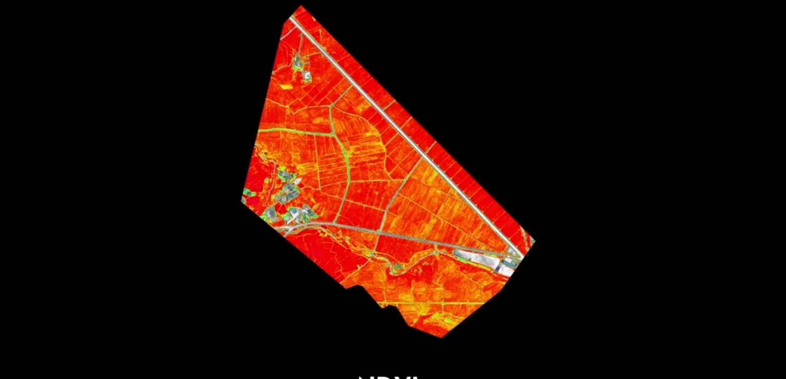
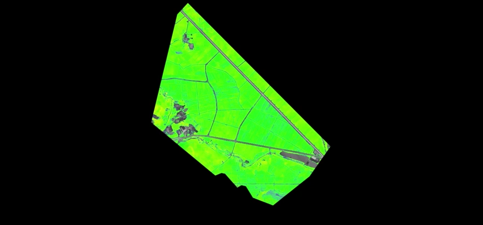
Using DJI Mavic 3 Multispectral and P4 Multispectral data, vegetation index maps including NDVI and NDRE can be created to provide information on plant growth and condition, radiometric correction is supported, and reflectance maps can be created for remote sensing studies. Recipe maps can be created for variable rate applications using DJI's Agras drones to increase crop yields while reducing costs.


Simple and intuitive interface to get you up and running quickly.
Run reconstruction missions with simultaneous use of multiple graphics cards for increased efficiency.
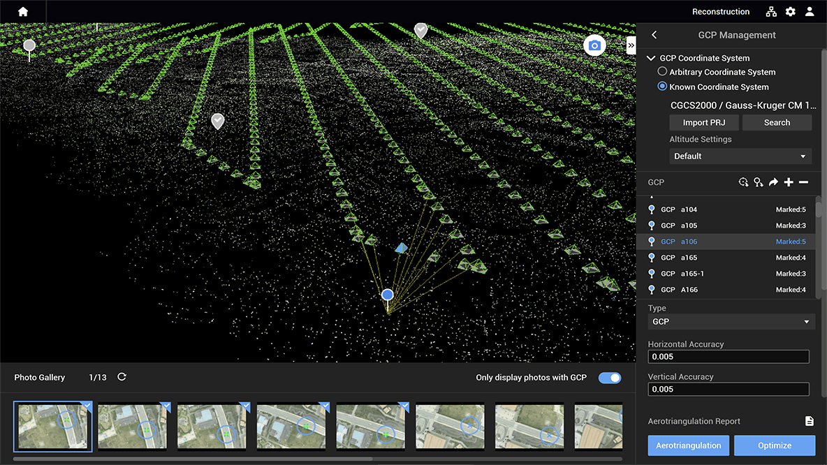
Automatic GCP support allows you to automatically recognize control points on a larger number of photos one mark at a time.
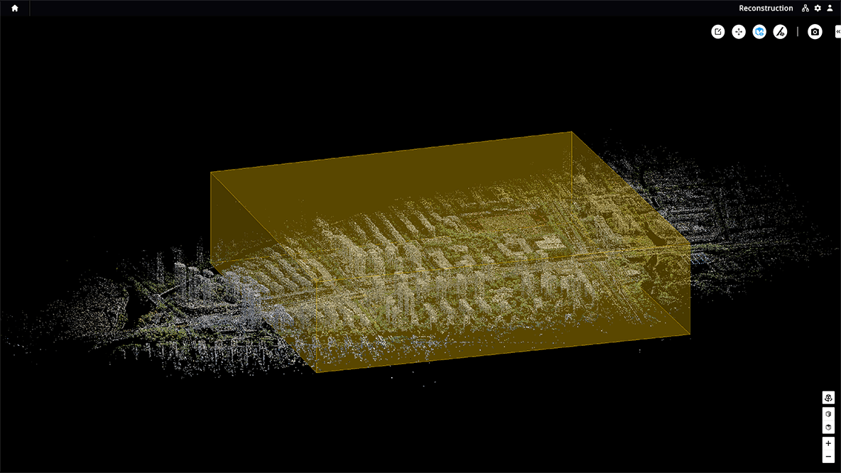
With Region of Interest (ROI) and locking, you can perform image reconstruction only in a specified region. This reduces processing time and increases efficiency by providing a sharper model or point cloud, as well as completing large-scale reconstruction and assembly.


If efficiency is important, quickly create and visualize a 3D model of the mapped area. Make decisions based on the preliminary model and immediately check it for completeness or plan 3D walkarounds on site.

Quickly create a 2D orthomosaic of the selected area in real time. This is not only ideal for creating detailed flight paths in remote areas, but is also useful for urgent tasks that require quick on-site decision making.
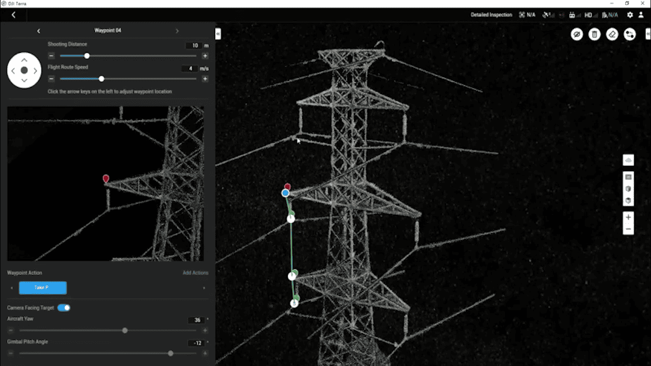
Automatically generate waypoints and flight paths based on one or more points selected from a local realistic 3D model or point cloud (or third-party point cloud). The simulated camera view including the selected point is displayed on the screen, allowing for better waypoint selection and more efficient flight path planning, automating inspection workflows.